Graphic Scores
Rob:
The sound works in this project are being created using a mix of field recordings taken around Aldborough – both above and below ground – and composed musical elements. Just as with the field recordings, I wanted the compositional parts of the project to be led by the characteristics of the landscape. Through their work over the last decade with the Aldborough Roman Town Project, Rose has mapped the sub-surface landscape of the village, creating incredible detailed maps of the Roman remains beneath the topsoil.
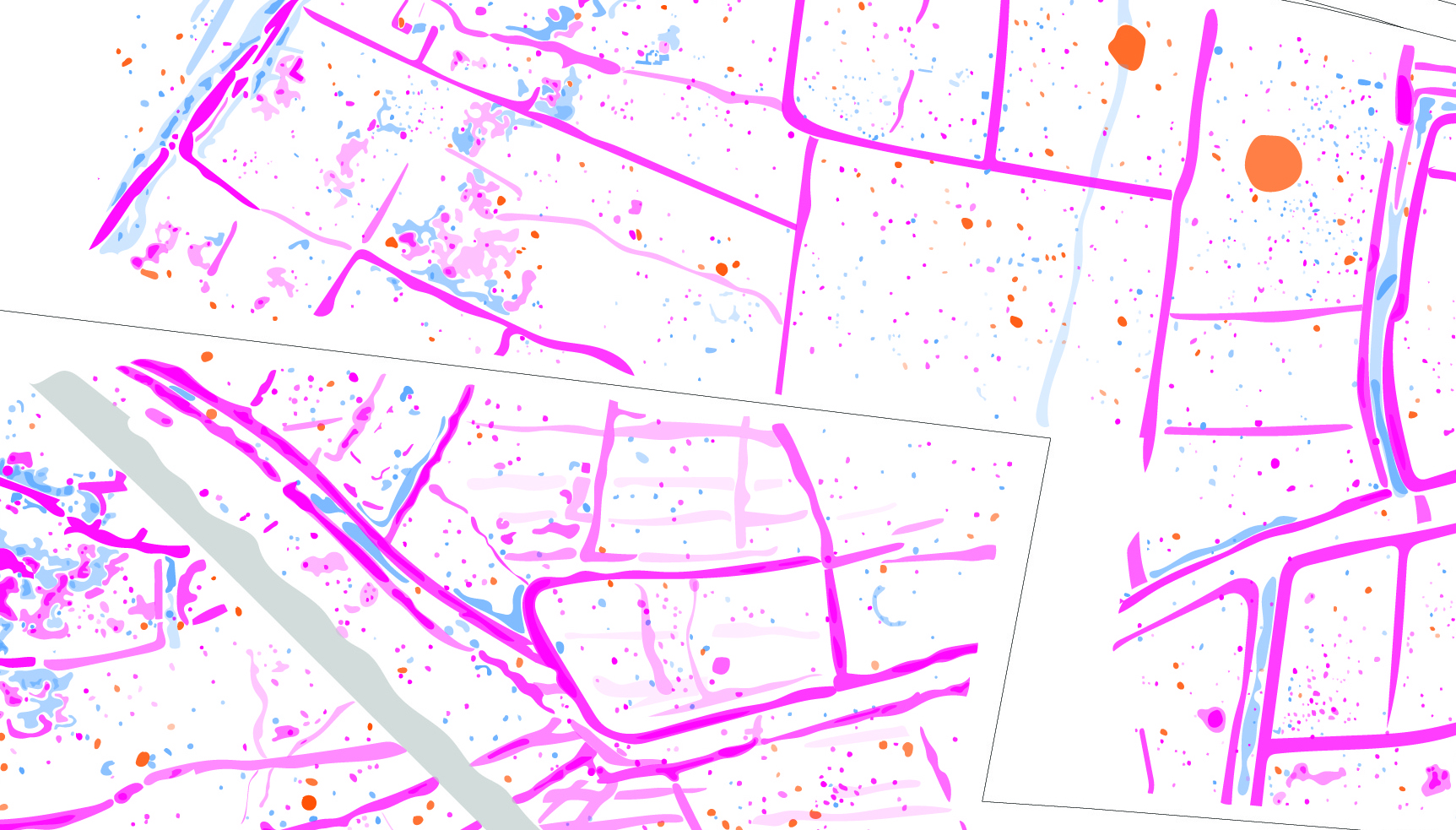
These maps are artworks in themselves; abstract patterns of human activity, construction and destruction over hundreds of years. As I wrote about in a previous blog, different parts of the landscape are termed ‘noisy’ or ‘quiet’ depending on their magnetic traces. I wondered how these maps might work as graphic scores which could generate notes, chords and rhythms: the music somehow emerging from the landscape?
Working with my long-term collaborator Pete Harvey, these maps have been slowly turned into music. We’ve been overlaying staves onto the maps and attempting to interpret the resulting arrangement of patterns into short melodies – scoring the ground, in other words. These melodies are then turned into MIDI – a digital musical language – allowing the patterns to be played back on a variety of instruments (such as Roman lutes).
They are then dubbed onto reel-to-reel tape (itself a magnetic form of memory), and chopped, spliced and looped, yielding new patterns and rhythms. Some loops have been further altered using materials from the Aldborough landscape – river water, dig spoil, alluvial core sediment – allowing processes of weathering and decay to etch new patterns into this emergent landscape music.
Rose:
Interpreting the abstract data form provided by the geophysics at Aldborough is as much an art as it is a science, and as much about the thought process as it is the finished product. I have spent years trying to find ways of visually representing the monochrome plans; attempting to capture the nuances whilst also simplifying, clarifying. Archaeologists dealing with this sort of data go about it in very different ways: for some, the interpretation image is based purely on numerical data, whilst for others (like myself) it is more a visual reading of tone. Either way, we end up with final interpretation images that are artistic tracings of invisible, sensed features.
The final interpretation drawing I made for Aldborough was years in the making. I adjusted the transparency of features to echo the strength of signal, found ways of showing how features intersected or related. And in the process, this map of the sub-surface became etched in my mind: the invisible landscape of Aldborough constantly there as I look out across the fields. But one of the things I was keen to explore with Rob was how we might stretch this interpretation.
Sound offers a fluid way of imagining; it is not telling one story, but gleaning atmosphere, space, reminders of place. Both sound and geophysics resonate with signals, and I’ve been excited to talk with Rob about how these might connect.
Interestingly, Rob hasn’t gone back to the original data for inspiration, but to the interpretation. In scoring my marks, another layer of archaeological thought is being created; one that can flow across the landscape in a musical cartography. I like the idea that Pete is up in Scotland reacting to imagery that I know so well, but to him is something different. It has become a compositional guide, that will then be abstracted again by Rob’s tapeloops, new readings and ways in created to this complex landscape.
These are musical excavations. They will join the archive of Aldborough alongside the context sheets, databases, lantern slides and notebooks. I love this blurring of boundaries: the way archaeology allows you to explore not just what is in the ground, but the myriad ways there are of exploring and sharing it.
You can find out more about the geophysical surveys and sub-surface archaeology at Aldborough on the Aldborough Roman Town Project website. A new, open access interactive map of the archaeology at the site is available here.